Today was our first day out on the wreck. We had planned our missions based on bathymetric models collected during last year’s expedition. The wreck is on a terrace at the base of a cliff with a steep 7m underwater cliff on the outside edge of the site. We completed a multibeam survey over the entire site to provide context for subsequent dives.
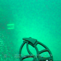
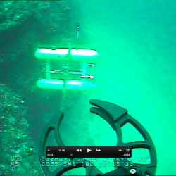
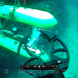
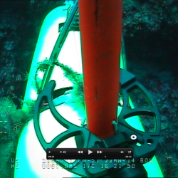
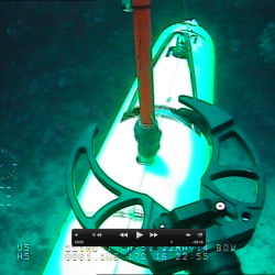
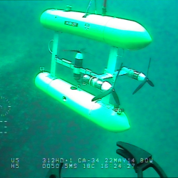
We then commenced an imaging run at 2m altitude. The vehicle descended and began heading across the site. We had planned for it turn before the underwater cliff but the vehicle travelled off the cliff, following the base before turning to make its way back up to the wreck site. USBL tracking from the surface suggest that it might have been stuck. The vehicle was aborted but remained at the base of the cliff. The decision was made to deploy the ROV to effect a recovery. The following images capture some of the moments leading to the recovery of the vehicle. It was stuck under a fishing line draped across the cliff.
Following those anxious moments we decided to continue the survey. Part way through the imaging run the camera system appeared to stop capturing images. The vehicle returned to the surface and we opted to conduct multibeam surveys at two other sites of interest further offshore before returning to the harbour to investigate the issue further.